In this edition of The Bridge Guy, we pick up the story of the Murrow Bridge well into its fifth decade. By this point, the bridge has seen little in the way of preservation. Free water was still being used for ballast, house jacks were still being used to jack cables and many features of the bridge had outlived their useful lives. The bridge was narrow and even after the removal of the draw span the reversible lanes endured, making it a dangerous place to drive. But all of that was about to change.
As with all floating bridge projects, a certain amount of political fighting must take place before such a bridge is even contemplated. After the Second Lake Bridge was built, discussion raged over whether a third span was needed and where it would be located. These discussions ranged from the outrageous to the absurd. At one time, 14 lanes were considered for the new interstate crossing. One proposal even had the Murrow Bridge being dedicated for Mercer Island residents only.
Eventually, it was decided that in order to complete the interstate highway system, Interstate 90 would need to be connected with Seattle as its western terminus. The route for this new portion of I-90 was then selected as the route crossing Lake Washington via the East Channel Bridge, Mercer Island and the Murrow Bridge.
As the Murrow Bridge was woefully inadequate to carry the I-90 designation, WSDOT was determined to build a parallel span next to the Murrow Bridge. This crossing would become known as the Third Lake Washington Bridge. Along with the new span would be a new Mount Baker tunnel, incorporating a large lid at the west end to allow for traffic to “unstack” on the Seattle side. But Mercer Island would not be outdone and they got a lid over their new highway monstrosity.
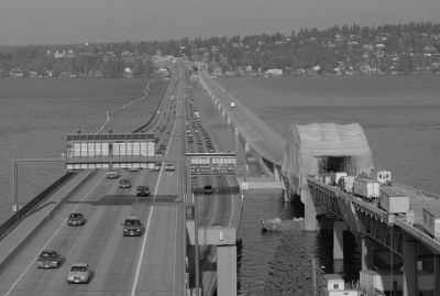
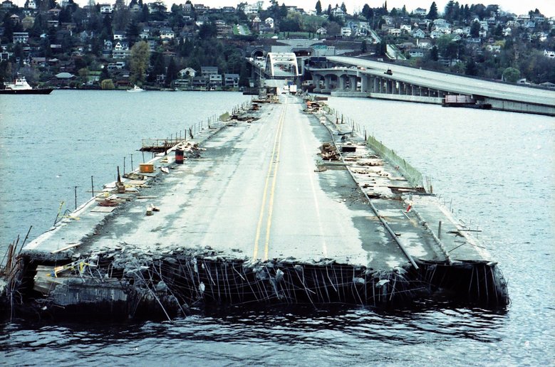
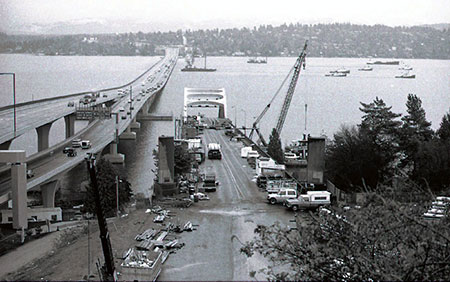
Third Lake itself would become the world’s widest floating bridge, a title it would hold until 2016, incorporating a dedicated mixed use pedestrian/bicycle path, dedicated westbound lanes and reversible lanes separated by a barrier. With design beginning as far back as the 1970’s, some of the more radical concepts included parallel pontoons to achieve the desired width. After a few iterations, designers opted for wider pontoons with cantilevered overhangs on each side, the only floating bridge to use a cantilevered deck.
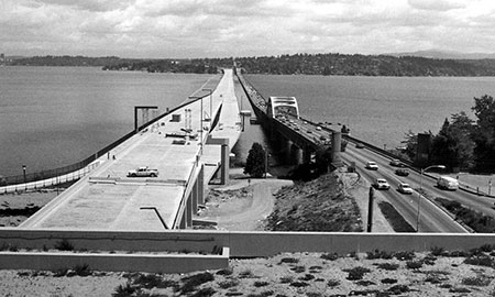
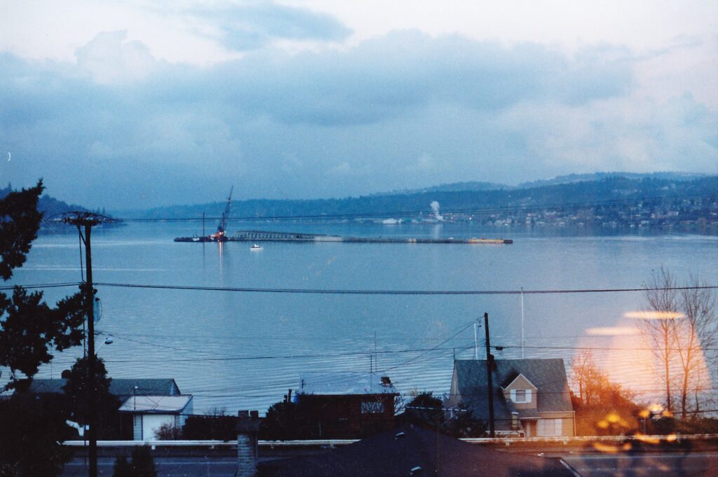
Construction on Third Lake began in 1986 and the new bridge opened on June 4, 1989. And all of that in a nice package located just 60 feet north of the existing Murrow Bridge. Meeting all of the current interstate highway standards, there was just one thing missing – what about eastbound traffic?
With the Third Lake Bridge sorted, engineers’ turned their attention to the Murrow Bridge. It turned out that the bridge needed more attention than just a widening. It needed a renovation.
Below is a list of some of the items that were to be addressed as part of the renovation of the Murrow Bridge:
- Numerous electrical upgrades, including interior lighting at the bolted joints, cable ways and access hatches.
- Communication systems
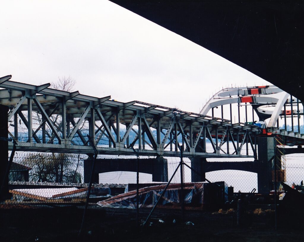
- Overall widening of the bridge approaches. This included replacement of both approaches (Arvid Grant would design the reinforced concrete box on the Seattle side while ABKJ designed a post-tensioned box girder for the Mercer Island side). Both arch spans were to be widened. The transition spans would get new concrete decks, replacing the open grid decks.
- Widening of the floating portion from a 43’-6” roadway to a 54’-0” roadway. To do this, the curb, sidewalk, barrier and entire corner of the pontoons would be removed. The bridge would get new joints, a Latex Modified Concrete overlay and new lower deck rails.
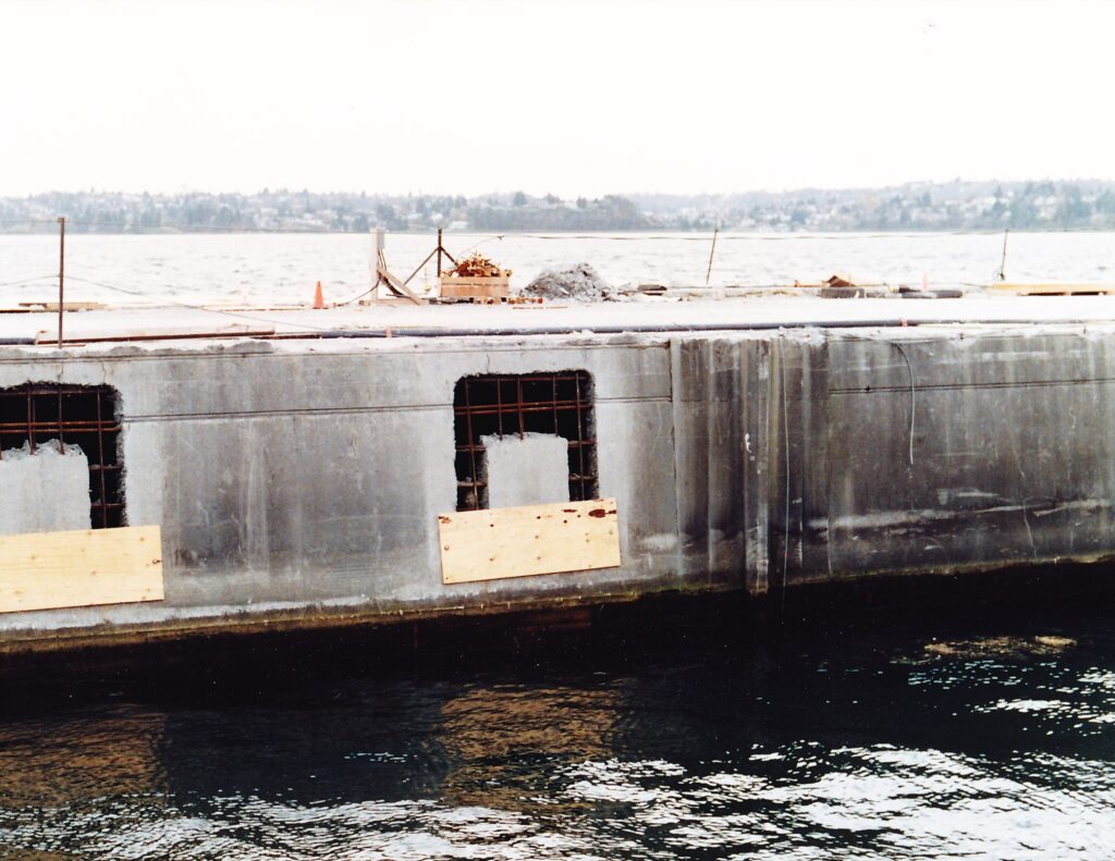
- New access hatches. With the exception of Pontoons L, G, X, Y, Z and D, all pontoons had their roadway hatches removed and relocated to the north wall of the pontoon. This would make access easier for maintenance since there would no longer be a sidewalk. It was also safer to have access away from traffic. The four L and G pontoons were highrise pontoons and had a lower deck to place deck hatches. The other pontoons had deck hatches installed for various reasons – D had longitudinal cables, thus making hatches in the wall difficult to locate. X, Y and Z were post-tensioned pontoons, installed to replace the draw span Pontoons M, H, J and K, and wall hatches would have required cutting into the post-tensioning.
- New drainage systems to drain runoff from the roadway into the moat between the Murrow Bridge and the new Third Lake Bridge.
- Ballast would be replaced with gravel. New catwalks would be installed.
- The cable adjustment device would be replaced with a new system, incorporating 150 ton rams on each cable way. In addition to this, some cables would be replaced and a new cathodic protection system would be installed.
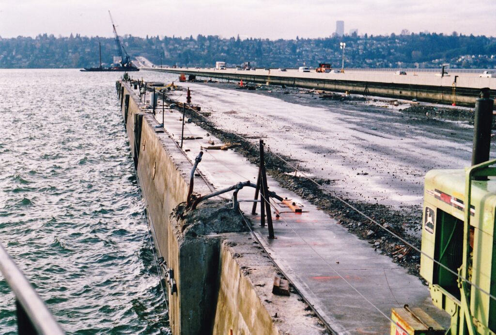
The approach deck on the Seattle side was in poor condition and the bridge crew spent a lot of time patching and holding it together. In some spots, there were holes all the way through the deck that maintenance kept patched. The signature navigation channel arches were to be cut in half and moved apart to accommodate the widened roadway. On the floating portion, the widening would allow for three interstate size lanes and shoulders where the bridge had none before.
In short, the bridge would have a new lease on life going into its sixth decade.
Work on the renovation began almost as soon as the ribbon was cut on Third Lake. Westbound traffic was moved to the new bridge with double the capacity of the old bridge. Three lanes of Eastbound traffic were placed in the reversible lanes. Traffic would remain in this configuration until September 1993.
Work on the renovation was awarded to Traylor Brothers. Now, in those days there were no restrictions on when work to a floating bridge could occur and Traylor Brothers would opt to work year round on the renovation. Unfortunately, this included work that could compromise the watertight integrity of the bridge during the most vulnerable time of year for any floating bridge – storm season.
Construction on the bridge compromised the watertight integrity in two main ways. First, removal of the entire corner of the pontoons meant that a giant gash would be left in the pontoon, which could allow rain and splash water into the pontoon. Second, the installation of the hatches in the pontoon walls meant that large holes were cut in the side – a mere 2’-0” above the waterline. Indeed, in some places it was permitted to include the hatch removal into the corner removal limits – making a big hole even larger.
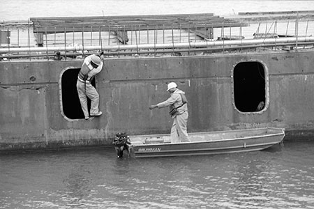
To do this work, Traylor Brothers elected to use hydrodemolition – basically high pressure water. Like a pressure washer on steroids. Incidental accumulation of water from the hydrodemolition process, rain (after all it rains constantly in Seattle) and lake splash probably occurred. Traylor was permitted to store hydrodemolition water in up to four cells on the bridge (out of 2200 on the bridge) temporarily during the work. Initially, they started demolition with two machines but this increased to four by November 1990.
No doubt you are all thinking, what an idiotic idea to store water in a floating bridge. Yes, you may be right but hindsight is 20/20. It was thought that without live load on the bridge there was some reserve buoyancy. However, recording of water levels both before and during construction on the bridge could be described as lax to non-existent.
During construction, it was pointed out that the new holes being cut for the hatches were only a mere inches above the water line in some areas. Wakes from boats, heck even normal wave action meant that water had an easy way to enter the bridge. To alleviate the concern, plywood planks were placed along the bottom of the holes.
In Seattle, winter storms are fairly mild. When low pressure systems enter the Strait of Juan de Fuca, high pressure forces winds out of the south toward the low. What makes this worse is the topography of Western Washington. With the Olympic Mountains to the west of Seattle and the Cascades to the east, these winds have no place to go but to rush north through the Seattle Metropolitan area. Notable storms include the Columbus Day storm of 1962, the Hood Canal Bridge storm of 1979 and the Inaugural Day storm of 1993.
As workers closed up shop for the Thanksgiving holiday weekend on November 22, there was a storm looming. A long duration storm, some 30 hours, brought heavy rain and sustained winds up to 35 mph to Lake Washington. By November 24, the storm finally relented.
Traylor Brothers along with a WSDOT inspector were out on the bridge until 6:00pm on Saturday the 24th pumping water out of the bridge. When they left the bridge, they felt the bridge was in good order. What happened next defied belief and was a national sensation for days to come.
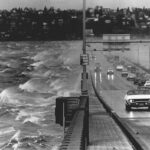
Witnesses and video footage seems to indicate that the sinking began in Pontoon A5, near the center of the bridge. The actual amount of freeboard on the bridge was not recorded and investigators could not agree on the likely cause that triggered the sinking. If the water level was well below the hatch level, then cracks that widened as a result of the storm allowed water to seep into the pontoons, lowering the bridge in the water until the water level came up to the hatches. If the water level was higher than witnesses recalled, water may have splashed up and around the plywood edges. Either way, A5 suddenly taking on water led to a chain reaction.
The sinking began around 9:30 Sunday morning, November 25, 1990. As A5 took on water and sank, the fact that the pontoons were bolted together meant that adjacent pontoons A4 and A6 were also pulled down. This allowed further water to enter those pontoons, perpetuating the sinking. Eight of the 22 pontoons that made up the Murrow Bridge eventually sank while the world watched.
Sinking progressed to the east, claiming Pontoons A5 to A10. As A10 sank, it started to take Pontoon X with it. However, Pontoon X was not to receive hatches installed in the walls like the A pontoons, so as it was pulled down the pontoon retained its buoyancy. Eventually the post-tensioning anchorages that connected A10 to X were pulled out of A10’s bulkhead under tremendous force. A10 then separated from the rest of the bridge and sank. Though damaged, X remained afloat. The post-tensioning made the pontoon stronger and likely prevented cracking which could have continued the sinking. As a result, Pontoons X, Y, Z, E, D, G-2 and L-2 all survived.
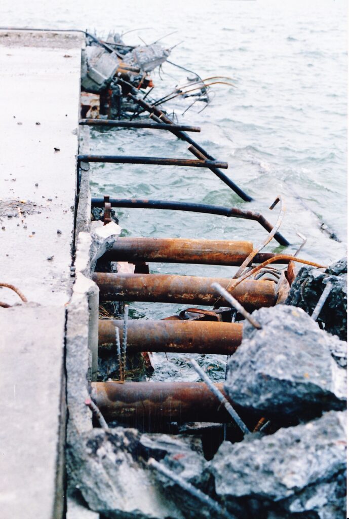
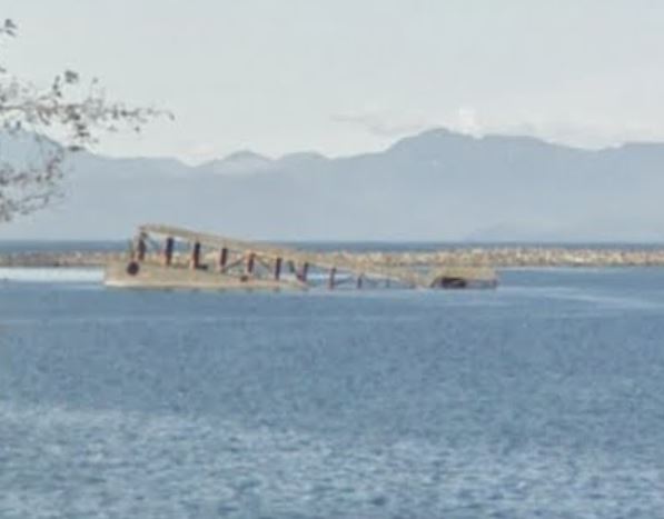
As the sinking progressed to the west, it claimed Pontoon A4. While it is purely speculation on the part of the author based on the available evidence, it is likely that construction had not advanced enough on A3 to continue the sinking. Perhaps hydrodemolition had not progressed that far? Perhaps the hatch holes had not yet be cut? A portion of the west highrise (Pontoon L-1) also sank. You can dive this wreckage!
In the immediate aftermath of the sinking, which occurred adjacent to another floating bridge, 13 anchor cables of the Third Lake Bridge were damaged or severed. As the pontoons sank, they landed on and slid down the Third Lake cables. In one case, pontoon debris landed on top of three of the Third Lake Anchors. To this day, the southeast longitudinal cables on that bridge are anchored to the sunken pontoons.

With the loss of the anchor cables on Third Lake, there was concern for the structural stability of the bridge. Luckily, several ocean going tugboats were on their way back to the lower 48 after being in Alaska to assist with the Exxon Valdez oil spill. The tugs were employed to hold the Third Lake bridge in place. So dire were the circumstances that the tugs merely nudged up to the north side of the bridge and pushed at full throttle. These tugs were so large and pushed so hard that they damaged the pedestrian rail on the bridge. The thrust from the tugs disturbed sediment on the bottom of the lake 200 feet below!
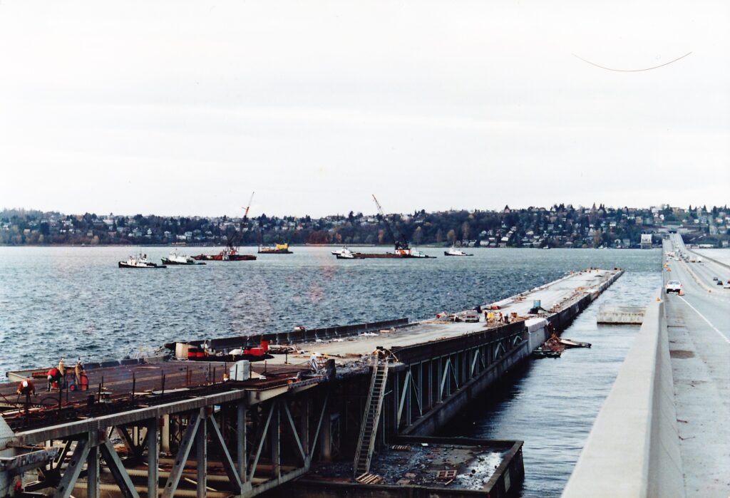
Eventually tugs from Foss were brought in as a longer term solution to stabilize Third Lake until new anchor cables could be installed. These tugs were run around the clock, seven days a week. Large ship anchors were also used to temporarily anchor the bridge, but these just did not have the holding power required.
There was some concern by managers with WSDOT that had another storm come along from the south before Third Lake could be stabilized, the bridge could have been damaged and broken apart. If that were to have happened or the original Thanksgiving storm had not let up when it did, many believed that as there was nothing on the lake big enough to stop the Third Lake pontoons – they could have drifted north and taken out the Evergreen Point Floating Bridge. This potential crisis never materialized – the weather cooperated and Third Lake was stabilized. However, there was a real worry that the sinking of the Murrow Bridge could have easily resulted in the loss of all three Lake Washington floating bridges had things not gone the way they did.
There was some disruption to traffic as a result of the sinking. Due to concerns about the stability of Third Lake, the bridge was closed for some time until the needed repairs could be made.
The renovation contract was eventually canceled by WSDOT – there was no longer a bridge to renovate. The Department then filed a claim against Traylor Brothers asking for damages in excess of $140 million. Traylor Brothers responded with a claim of their own for $28 million. Governor Booth Gardner then convened a Blue Ribbon Panel, charged with investigating the sinking and its causes, restoring the public’s confidence in the State’s remaining floating bridges and recommending steps to be taken to ensure something like this would not happen again.

The Blue Ribbon panel was appointed on December 6, 1990 and it delivered its report to the Governor on May 2, 1991. Aubrey Davis, former Mercer Island politician and future Transportation Commission chairman, chaired the panel. The panel hired Wiss Janey Elster, noted forensic consulting engineers, to study the sinking. Ben Gerwick was retained to study the sinking by Traylor Brothers. Ultimately the panel could not definitively determine the true cause, although as Ken Carper of Washington State University put it, “After very extensive study and very sophisticated computer modeling methods, the conclusion was that concrete pontoons simply don’t float when they’re full of water.”
A number of recommendations were made by the Blue Ribbon Panel that more or less govern how WSDOT handles their floating bridges to this day. These recommendations are publically available in the report.
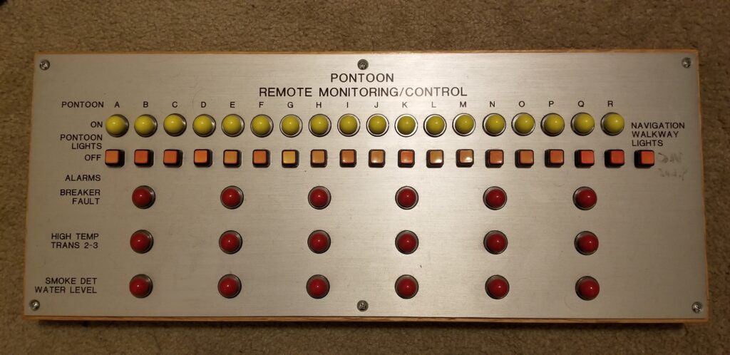
WSDOT retrofitted all of its floating bridges to have water alarms in all cells after the sinking. Third Lake only had alarms in the transformer cells, located in 6 out of 18 pontoons.
To this day, work which compromises the watertightness of a floating bridge is prohibited during storm season. For Lake Washington this is October 1 to March 31 each year. For Hood Canal, this is October 1 to April 30 each year. Strict criteria limiting work during inclement weather is also a part of every floating bridge contract.
In August 1992, Traylor Brothers’ insurers agreed to pay the State $20 million and dismiss all of their claims. Neither side admitted any responsibility for the disaster.
So what happened to the 14 pontoons that didn’t sink? At first, they were untethered and moved just off of Stan Sayres Park, just south of the bridge. Then they were moved to the south end of the lake near Gene Coulon Park until they could be sold. Consequently, this was the same area where the old draw span was sitting moored, almost ten years after being removed.
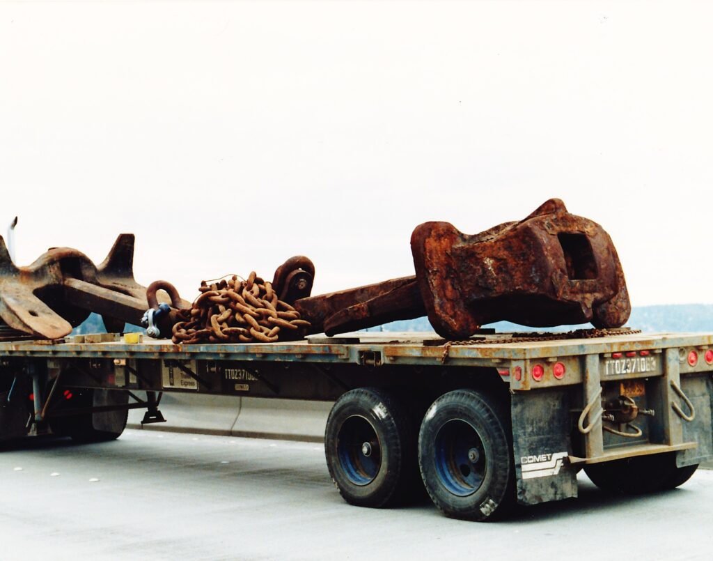
WSDOT then took bids for the old pontoons. Pontoon A1 was the most sought after, with a marina in Craig, Alaska bidding over $60,000 for it. Port Alberni on Vancouver Island has a 218 foot pontoon. Duke Point in Nanaimo, also on Vancouver Island has a 120 foot long pontoon. Tyee Marina in Tacoma has three pontoons which form its breakwater. Nearby Browns Point Marina has another one. Read more in this Seattle Post-Intelligencer article from 2002.
The Makah Tribe purchased five pontoons for $1,000 each. They were given a sixth one for free because of its poor condition. The State offered each purchaser about 20 miles of free towing to ensure the pontoons left the lake (refer to the previous article to find out what happened to the draw span). After towing their pontoons to Neah Bay to be used as a breakwater, things went a little sideways – literally. Funding or permitting fell through for the breakwater, and five of the pontoons were sold. One portion of the high rise, likely G-2 and L-2, remained in Neah Bay. During a storm, the moored pontoons swung around and hit a rock, causing the hunk of floating bridge to partially sink. Full of shrimp, it is still there today with a bit of the highrise still sticking out of the water.
I once mused to my Dad, “If it hadn’t sank in 1990, I wonder if the old bridge would still be in service today?” But before I could finish my question, he slowly shook his head, “Best thing that could’ve happened was that bridge sinking,” which just about sums it up. It’s like asking if John Kennedy hadn’t been assassinated, would he still be alive today.
In the next installment of The Bridge Guy, we’ll take an in-depth look at the replacement bridge that is still in service today. How was it designed? What was learned from the last bridge and all the others in between? What changes were made to it as a result of the sinking? Check back next week for more!
Views: 1102