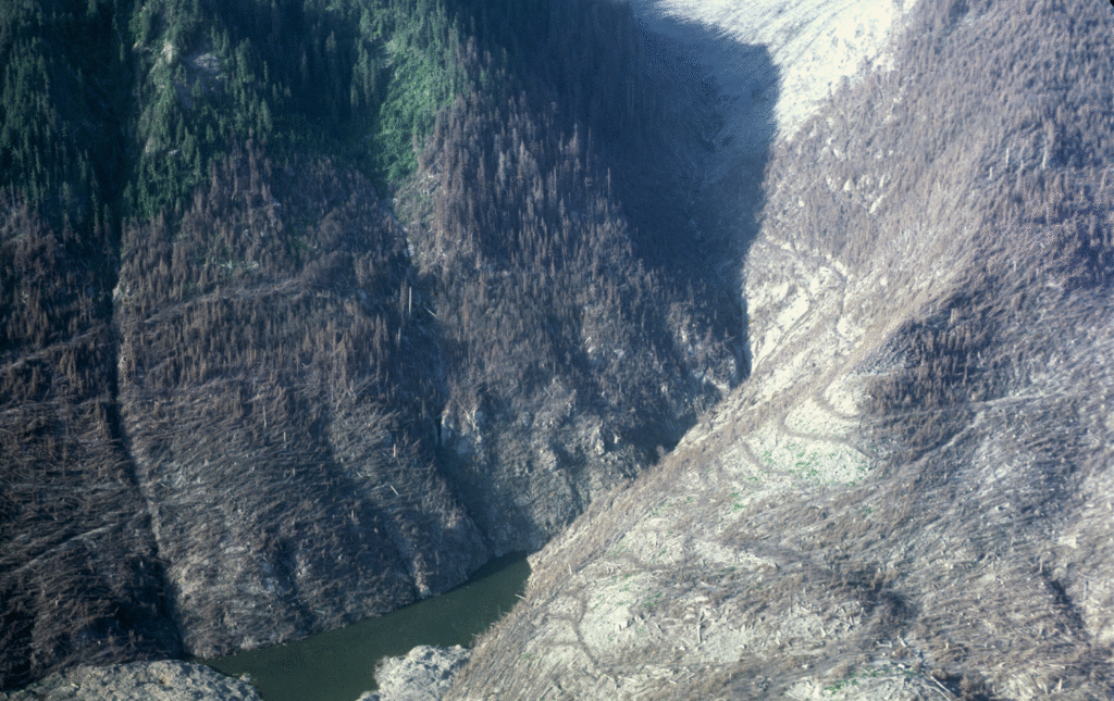
At 8:32am on May 18, 1980, a magnitude 5.1 earthquake triggered the collapse of the north face of Mount St. Helens in Washington State, the largest debris avalanche in recorded history. The pyroclastic flow, caused by the explosive release of magma from the mountain, would leave a trail of destruction over an area of 230 square miles. In an instant, the debris from the eruption liquefied ice and snow and mixed with water from nearby Spirit Lake to create lahars that traveled down the Toutle and Cowlitz river valleys all the way to the Columbia River.
And 45 years later, it remains the most deadly and economically destructive volcanic event in United States history.
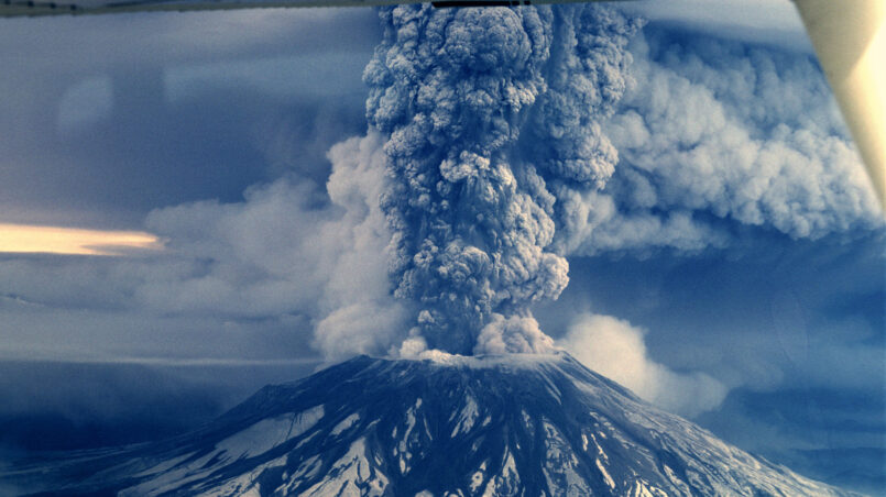
The eruption would release 24 megatons of thermal energy – about 1,000 times that of the Nagasaki atomic bomb – and ejected about two-thirds of a cubic mile worth of material. The extent of the destruction can still be seen today in the size and shape of the crater left by the eruption. The height of the mountain was reduced by 1,300 feet, leaving a distinctive horse shoe shaped crater almost 2 miles across and over 2,000 feet deep.
For nine hours, a plume of ash poured from the mountain, eventually reaching 16 miles into the atmosphere. Once the ash hit the jet stream, it was moving eastward at a mile a minute. Ash was falling on Idaho by noon and Edmonton, Alberta by the next morning. In all, 57 people, nearly 7,000 big game animals and an estimate 12 million hatchery fish were killed during the eruption.

The economic effect of the eruption on southwest Washington was tremendous. Nearly 200 homes were either damaged or destroyed, along with 185 miles of highway and 15 miles of railway.
The eruption, or more specifically the resulting lahars, also destroyed 47 bridges over the Toutle and Cowlitz rivers and their tributaries.

In the path of the destruction was the Spirit Lake Highway, built by Cowlitz County in 1903. It was transferred to the State in the 1930s, and continued to be improved and expanded as its popularity grew. In 1964, the highway was renamed State Route 504 and was extended to the timberline of Mount St. Helens.
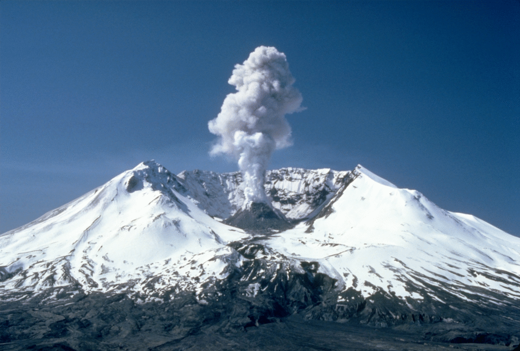
A large portion of the highway was destroyed during the eruption. The State would eventually rebuild the highway beginning in 1988, connecting to the new interpretive centers at Coldwater Ridge and Johnson Ridge within the newly created Mt. St. Helens National Volcanic Monument. The highway was moved to the north and raised in elevation in an effort to protect the highway from periodic high flows and damaging flood debris along the Toutle River.
One of the most impressive bridges to be built along this new stretch of highway was Hoffstadt Creek Bridge, the largest and tallest of the 14 bridges built along SR 504 in the wake of the eruption. This continuous deck truss has a main span length of 600 feet and rises 370 feet above the valley below. The size and scale of this bridge can only be fully appreciated from the west end viewpoint.
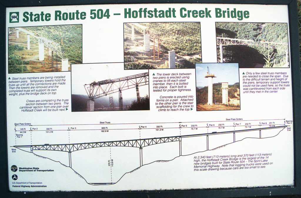
To erect the bridge in such a remote area, the contractor built the steel approach spans on falsework, then cantilevered the truss out over the valley. The truss measures 56 feet in depth at the piers and contains 2,505 tons of steel. The bridge opened in 1991 at a cost $12.6 million.

Landslides on SR 504 don’t just occur due to volcanic activity. On May 14, 2023, a large mudslide destroyed a bridge near Johnson Ridge. The slide carried the superstructure downstream, leaving only the abutments and portions of the approach slabs behind. The only remnants found of the bridge was some of the epoxy coated rebar from the bridge deck. Mother Nature is not a force to be trifled with!
Sometimes our greatest achievements in bridge engineering occur as a result of disasters like the eruption of Mount St. Helens.