In this edition of TheBridgeGuy, we’re changing it up a bit. This post is going to be more of a photo blog of the bridges of Singapore, specifically the bridges along the Riverwalk. This will be the first of two posts. On the first day, I started at the Ord Bridge and worked my way down river, ending near Marina Bay. In the second post, I’ll be starting at the Ord Bridge and working up river.
Many of these bridges are the second or third or even fourth bridge at the site. As the city continued to develop, the bridges needed to be upgraded to cope. Some of the bridges no longer carry vehicles, having been restricted to pedestrian loads years ago.
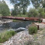
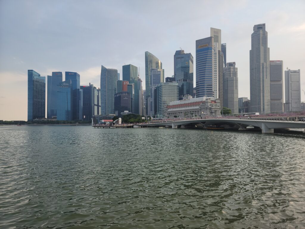
You will also see a preponderance of white paint in these photos. The white paint on the steel work gives the bridges a clean appearance during the day, while allowing for lighting to dress the bridges up at night.
The Ord Bridge
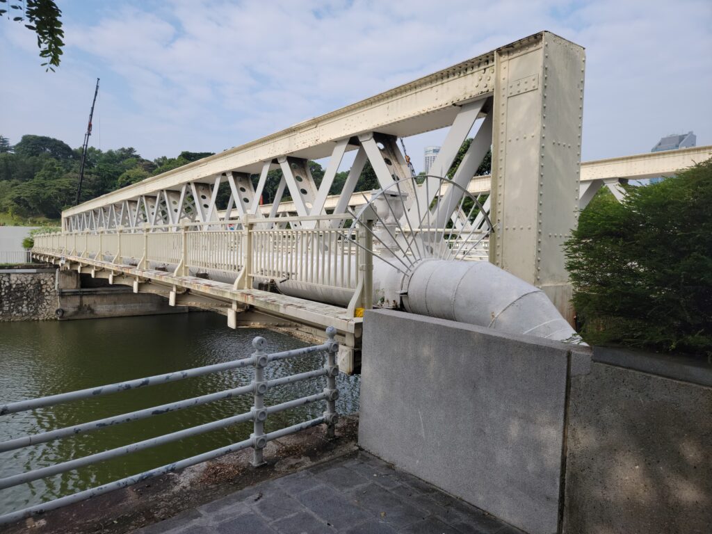
Located near Riverside Point Mall and Clarke Quay, the Ord Bridge is a pony truss bridge with large box shaped chords and only diagonal web members. It was opened in 1886 and named after Sir Harry St George Ord, Singapore’s first Governor after it became a colony of the British Crown in 1824.
The bridge originally linked River Valley Road to Magazine Road, where ammunition was stored. At one time, the bridge was painted green giving it the name ‘The Green Bridge’ in many of the local languages. It was also known as the Toddy Bridge as many shops in the area still sold toddy (palm liquor) up to the 1970’s.
The Read Bridge
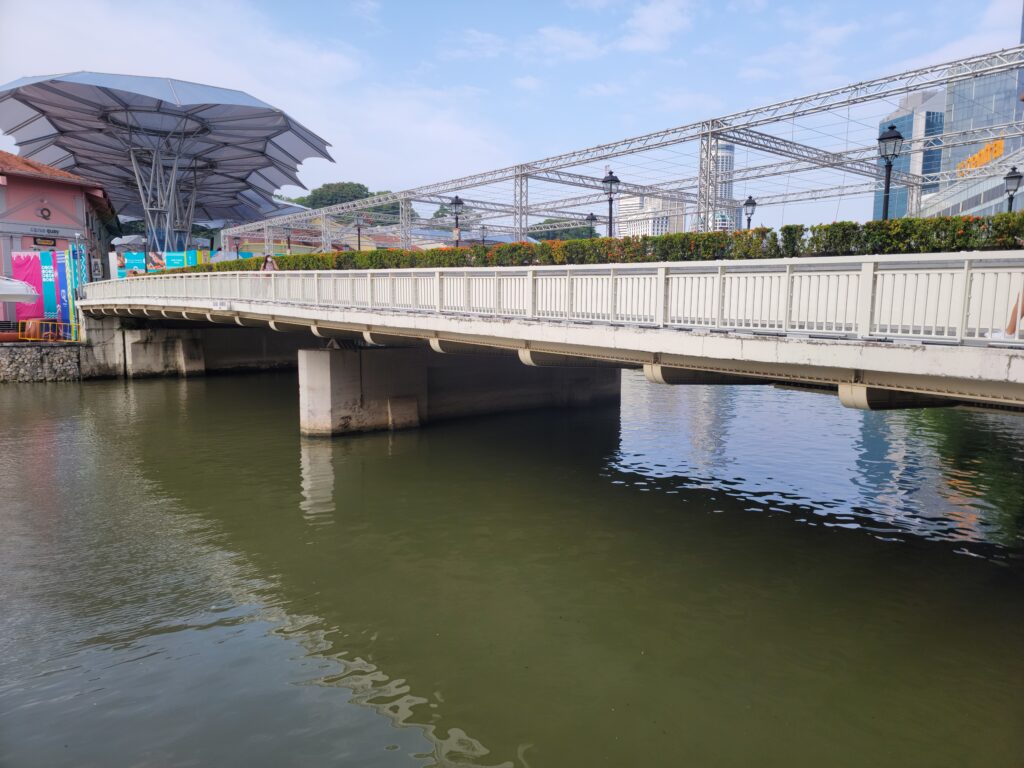
A bridge has been at this location since 1863. The first bridge was built too low for tongkangs (traditional river boats) to pass, thus it was replaced in 1889. The Read Bridge is named for William Henry Macleod Read, a prominent businessman and politician.
The bridge was located near Kampong Melaka, an area originally settled by Malay traders and fisherman from Melaka in the 1820’s. It was also a gathering point for Teochew laborers who would gather to listen to storytellers in the evenings.
While photos of the bridge indicate a two span arch structure, the bridge of today lacks the arches. The bridge was extensively repaired in 1991 and converted into a pedestrian bridge as part of plan to beautify the bridges along the Singapore river.
The Coleman Bridge
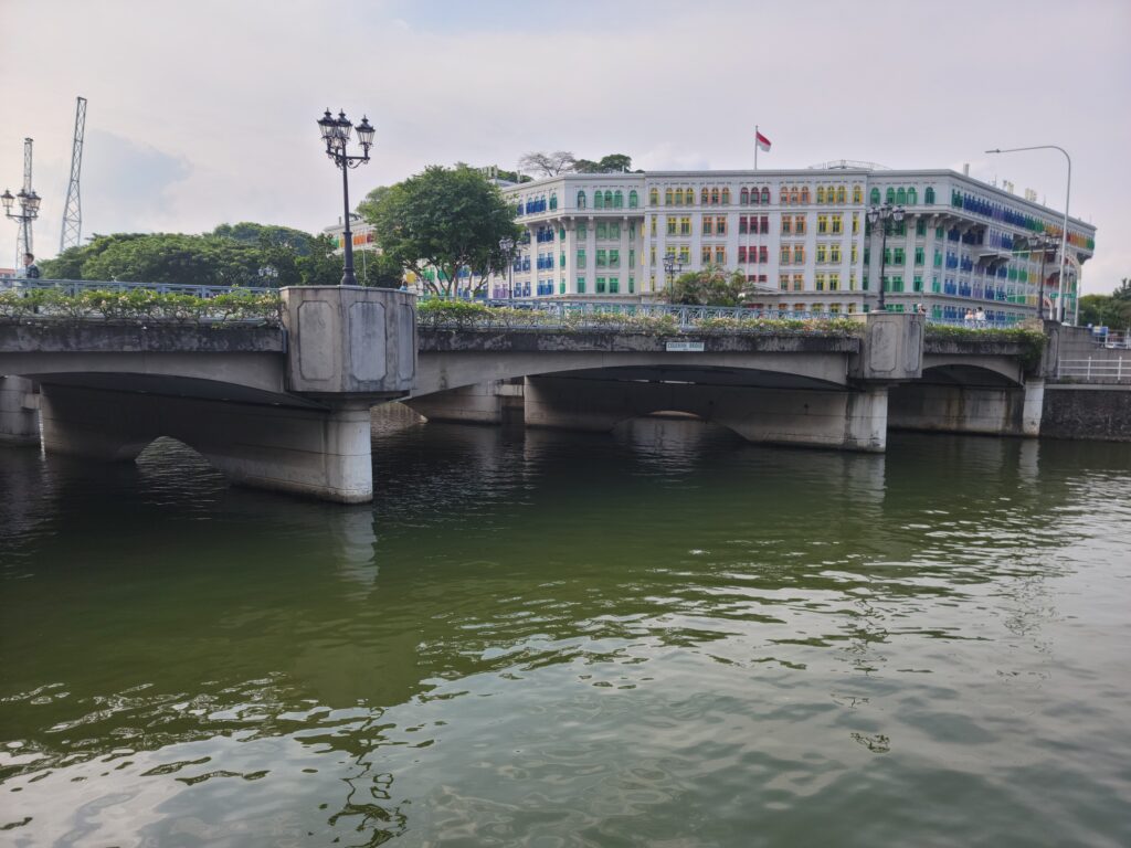
A vehicle bridge carrying Hill Street, this bridge features pedestrian tunnels near the abutments. This feature, common in Singapore, limits the amount of at grade crossings pedestrians need to have with vehicles, which improves safety.
The Coleman Bridge is mainly concrete with arched soffits and reminds you of London.
The Elgin Bridge
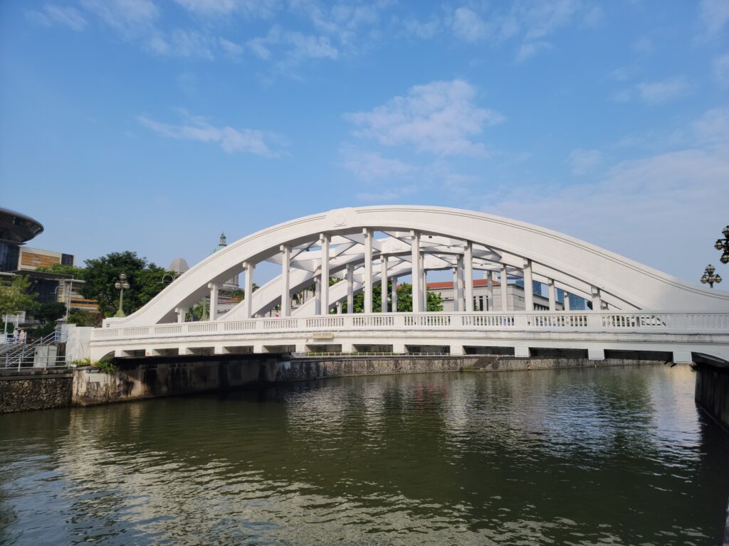
Though not the oldest bridge across the Singapore River, the Elgin Bridge does sit on the site of the first bridge across the river, which was built in 1819. The Elgin is the fifth bridge at this location, completed in 1929 and named for Lord Elgin, then Viceroy of India.
The bridge is a steel tied arch with three arch lines to give it strength and redundancy. The cast iron roundels in the ends of the ribs were designed by Rodolfo Nolli, notable for his other work in the Singapore area.
The Cavenagh Bridge
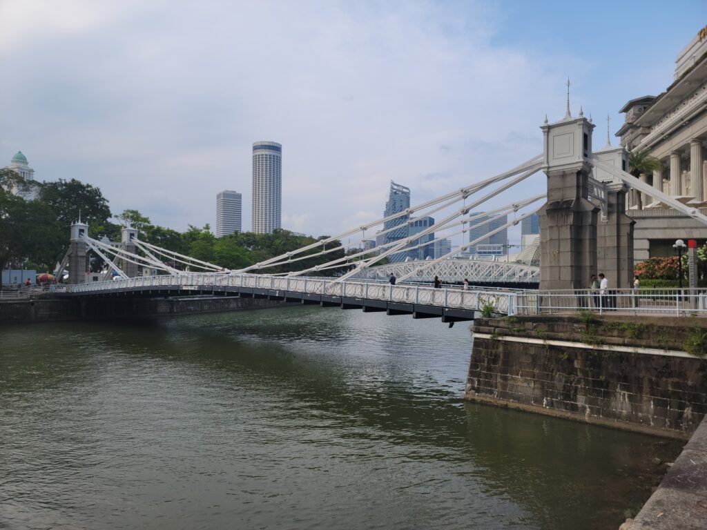
The oldest bridge across the Singapore River to survive in its original form, the Cavenagh Bridge is located between Empress Place and the Fullerton Building, which linked the colonial offices with the financial district.
Before the bridge was built, the only way across the river was via a temporary footbridge or by boat. Named after Governor Sir William Orfeur Cavenagh, the bridge was completed in 1869. It was one of the first suspension bridges in the region. Using steel eyebars rather than cables, locals called it ‘Hai ki thih kio’ which is Hokkien for ‘Iron suspension bridge by the sea shore.’
The bridge was converted into a pedestrian bridge after 1910 when the nearby Anderson Bridge was completed.
The Anderson Bridge
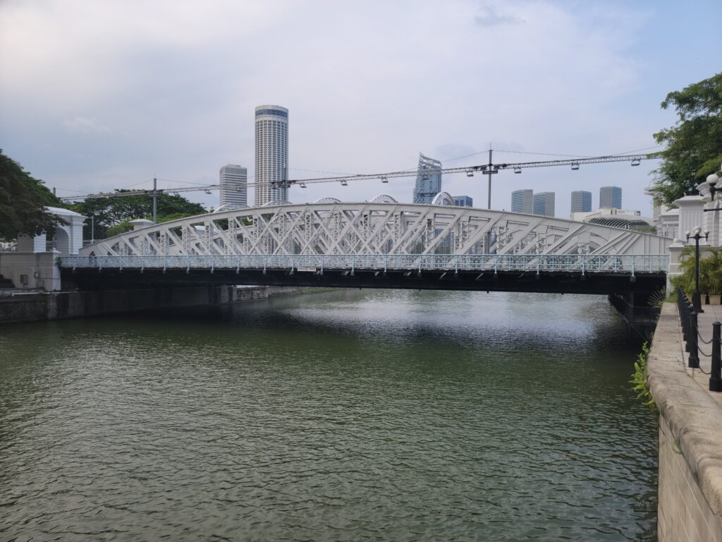
This bridge was built specifically to take vehicular load off of the Cavenagh Bridge. Named after Sir John Anderson, Governor of the Straits Settlement, the bridge is a steel arch with three arch lines, enabling it to carry vehicles as well as electric trams.
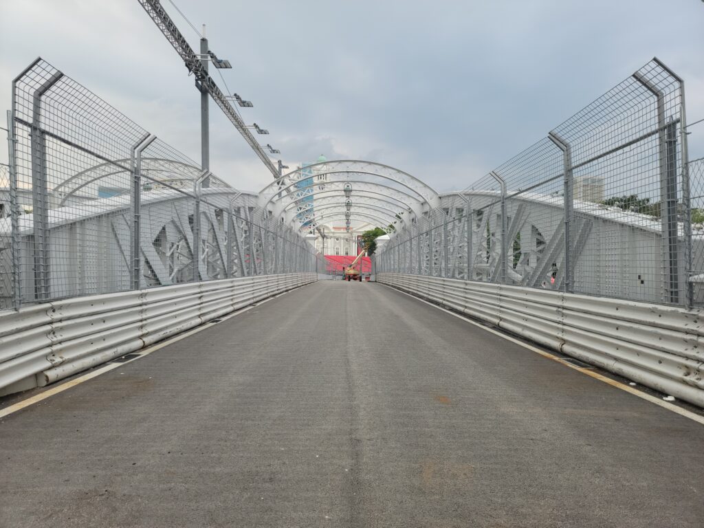
The Anderson Bridge will serve as part of the Singapore Grand Prix on September 17, 2023. The author is leaving, sadly, on the 10th and will miss the race!
The Esplanade Bridge
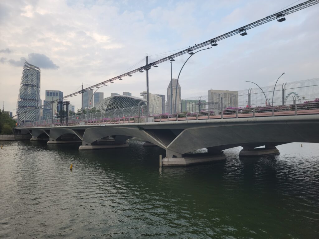
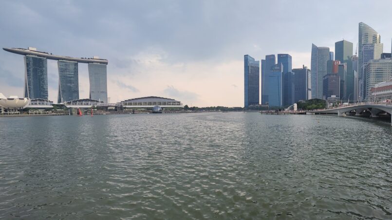
A low level concrete arch bridge, the Esplanade Bridge was built to improve traffic flow across the river and displace traffic from the Anderson Bridge. Completed in 1997, the bridge blocked the view of the famous Merlion statue from the Marina Bay waterfront, which necessitated the move to its current location.
The Jubilee Bridge
Singapore remained a British colony through the second world war. The Japanese, however, occupied Singapore for much of the war. Angered at how the British had failed to defend its colony, this was the beginning of the end of colonialization in Singapore. In 1956, the case was made for full self governance.
Other British possessions in the region unified into what is today Malaysia in 1963, along with Malaya, Brunei, North Borneo and Sarawak. Singapore was a part of this conglomeration, though briefly. Political disagreements between Singapore and the rest of Malaysia led to tensions which culminated in civil unrest in 1964. Malaysia had had enough – they kicked Singapore out on its own. As a result, Singapore proclaimed itself an independent republic in 1965.
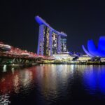
The Jubille Bridge was built to celebrate the country’s Golden Jubilee in 2015. A horizontally curved pedestrian bridge adjacent to the Esplanade Bridge, the bridge boasts fantastic views of the waterfront theater, Marina Bay Sands Hotel, the Merlion (which is located at the south abutment), the Singapore Flyer and the ArtScience Museum.
The Helix Bridge
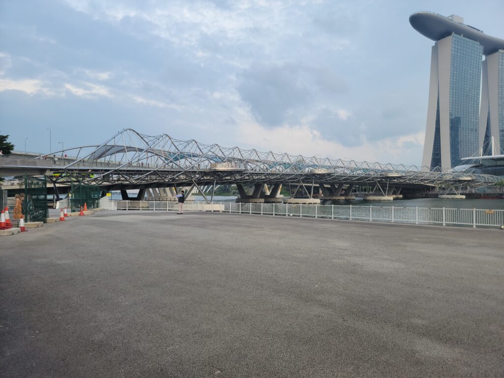
This 280 meter long marvel is comprised of two interlocking spiral steel tubes that twist in opposite directions. It resembles the double helix structure of DNA and symbolizes ‘life and continuity,’ ‘renewal,’ ‘everlasting abundance,’ and ‘growth,’ reflecting the key aspirations for Marina Bay.
Four viewing platforms give amazing views of Marina Bay and of the city. The Helix Bridge is strong, yet flexible – you can feel it move as joggers run past.
The architect was Cox Group, an Australian firm. The engineer was Arup, which seems fitting as Arup engineered the daunting curved roof structures for the Sydney Opera House. The bridge is constructed from 650 tonnes of Duplex stainless steel. Almost 1000 tonnes of carbon steel was used to erect the helix structure.
The Bayfront Bridge
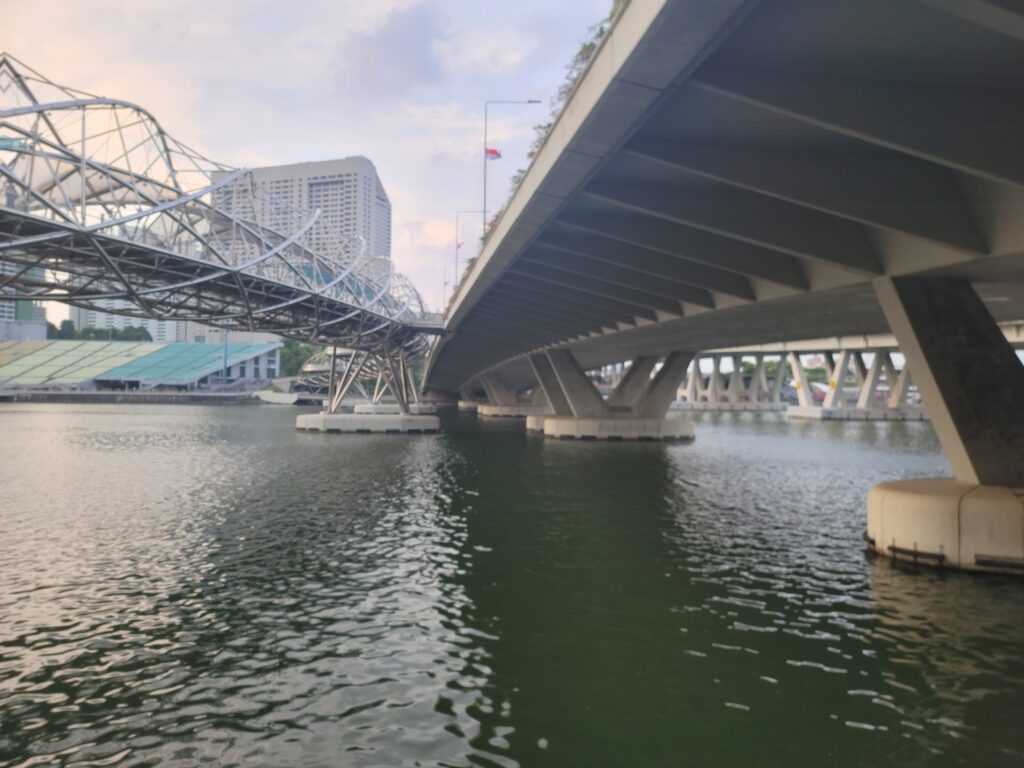
The Helix Bridge has a connecting walkway to the Bayfront Bridge, a concrete box girder bridge with V shaped pylon piers. It is a triple cell cast in place segmental, built using the balanced cantilever method. The wing supports are precast and were added to the structure after erection.
The bridge was completed in 2008 and carries Bayfront Avenue across Marina Bay.
The Benjamin Sheares Bridge

Named after the second President of Singapore, the Benjamin Sheares Bridge is both the longest and tallest bridge is Singapore (1.8 kilometers, 95 feet, respectively). Opened in 1981, four months after Sheares’ passing, the bridge is made from prestressed concrete girders and sits on reclaimed ground. It carries Sheares Avenue across Marina Bay.
Author’s Note: We here at TheBridgeGuy do not consider dams as bridges, so the Marina Barrage Dam is not going to be included here.
That concludes this edition of TheBridgeGuy. Stay tuned for the next installment where I will be working my way up river to look at more bridges from Singapore.
Views: 2227